

UK weather maps show exact date 47 counties battered by rain and thunderstorms
The UK is finally set for rain after months of warm, dry weather.

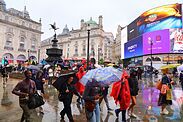
 [Rear view of two women under one umbrella walking the sidewalk in London downtown]
Britain is set for a barrage of rain after temperatures dropped across the UK following the countrys fifth heatwave of the year. New weather data from WXCharts.com shows large parts of the country turning yellow and orange as a wet weather deluge moves in on Thursday.
The worst conditions are concentrated across northern England, north Wales and the Midlands, where the maps show intense yellow, orange and red rainfall cells embedded inside a much broader area of wet weather. Parts of Yorkshire, Lancashire, Cheshire and the Midlands could be hit by particularly sharp bursts, while showers also pepper Scotland, Northern Ireland and Wales. The picture remains thoroughly unsettled into the afternoon, with powerful downpours capable of dumping a lot of rain in a short space of time.
 [A weather map of the UK showing rain]
Some areas may dodge the worst and stay largely dry between showers, but others could be soaked as individual cells pass overhead.
By 4pm the heaviest rain remains focused across northern and central England, while scattered showers continue from the Highlands down to the South East.
The UK recently experienced its fifth heatwave of the summer with the hottest day of the year recorded in Kew Gardens, London, on Thursday when temperatures reached 38.1C.
A Met Office meteorologist said that the south of the UK will experience changeable conditions with temperatures turning cooler and thunderstorms becoming a distinct possibility.
In a Sunday update, Met Office meteorologist Tom Morgan said: I cant promise rain for all of us through the week ahead, but in the south at least, its looking like the most changeable week weve seen here well at least since the end of June.
 [A weather map of the UK showing rain]
 [A weather map of the UK showing rain]
A jet stream which has been far in the north of the UK has allowed high pressure to dominate, causing the recent excessively hot conditions, Mr Morgan said.
Mr Morgan said it would travel south, meaning that low pressure will dominate, adding: So a much more changeable and at times unsettled outlook through the middle part of the week low pressure will dominate and slowly drift its way southwards.
He said it would start to turn cooler as wind switches to a northerly direction, adding: So as well as some rain, showers, and even thunderstorms in places, it will certainly feel considerably fresher than recent weeks in the south.
A Met Office forecast for Thursday to Saturday said: A northerly wind develops for the next few days, allowing temperatures to drop below average. Thunder showers for Thursday and Friday, but brighter and drier for Saturday.
Counties Impacted
England
- Cumbria
- Northumberland
- County Durham
- Lancashire
- Greater Manchester
- Merseyside
- Cheshire
- North Yorkshire
- West Yorkshire
- South Yorkshire
- Derbyshire
- Nottinghamshire
- Lincolnshire
- Staffordshire
- Shropshire
- West Midlands
- Worcestershire
- Herefordshire
- Gloucestershire
- Warwickshire
- Oxfordshire
- Kent
Scotland
- Highland
- Western Isles
- Moray
- Aberdeenshire
- Perth and Kinross
- Argyll and Bute
- Stirling
- North Lanarkshire
- South Lanarkshire
- Dumfries and Galloway
- Scottish Borders
Northern Ireland
- County Antrim
- County Londonderry
- County Tyrone
- County Fermanagh
Wales
- Anglesey
- Gwynedd
- Conwy
- Denbighshire
- Flintshire
- Wrexham
- Powys
- Ceredigion
- Carmarthenshire
- Pembrokeshire
- Monmouthshire




![[logo]](https://cdn.images.express.co.uk/img/logo/logo1.png)
![[Taboola above article placeholder]](https://cdn.images.express.co.uk/img/taboola-placeholder.jpg)
![[Add as a preferred source on Google]](https://cdn.images.express.co.uk/img/google_favicon_2025.svg)
![[Rear view of two women under one umbrella walking the sidewalk in London downtown]](https://cdn.images.express.co.uk/img/dynamic/153/590x/secondary/rear-view-of-two-women-under-one-umbrella-walking-the-sidewalk-in-london-downtown-7098861.jpg?r=1787039430851)
![[A weather map of the UK showing rain]](https://cdn.images.express.co.uk/img/dynamic/153/590x/secondary/Weather-1-7098863.jpg?r=1787039430866)
![[A weather map of the UK showing rain]](https://cdn.images.express.co.uk/img/dynamic/153/590x/secondary/Weather-2-7098864.jpg?r=1787039430873)
![[A weather map of the UK showing rain]](https://cdn.images.express.co.uk/img/dynamic/153/590x/secondary/Weather-3-7098865.jpg?r=1787039430880)
![[Weather icon]](https://cdn.images.express.co.uk/img/weather/png/52x52/icon_07.png)
![[Weather icon]](https://cdn.images.express.co.uk/img/weather/png/52x52/icon_15.png)
![[Weather icon]](https://cdn.images.express.co.uk/img/weather/png/52x52/icon_30.png)
![[Weather icon]](https://cdn.images.express.co.uk/img/weather/png/52x52/icon_03.png)
![[Weather icon]](https://cdn.images.express.co.uk/img/weather/png/52x52/icon_12.png)
![[Rain on umbrella background, weather forecast and environment concept]](https://cdn.images.express.co.uk/img/dynamic/153/590x/2240470_1.jpg)
![[Piccadilly Circus rain in London, UK]](https://cdn.images.express.co.uk/img/dynamic/153/183x122/2240405_1.jpg)
![[Commuters with umbrellas in the rain]](https://cdn.images.express.co.uk/img/dynamic/153/183x122/2240360_1.jpg)
![[Blackpool,UK]](https://cdn.images.express.co.uk/img/dynamic/153/183x122/2240352_1.jpg)
![[The strong storm with heavy rain on the road with poor visibility of cars. Concept of the danger of driving in bad weather]](https://cdn.images.express.co.uk/img/dynamic/153/183x122/2240334_1.jpg)
![[Person walking with Union Jack umbrella alongside road]](https://cdn.images.express.co.uk/img/dynamic/153/183x122/2240306_1.jpg)
![[Raging flood waters on the Under Loughrigg road in Ambleside, by Rothay bridge in the Lake District on Saturday 5th December 2015, during torrential r]](https://cdn.images.express.co.uk/img/dynamic/153/183x122/2240093_1.jpg)
![[BRITAIN-ENVIRONMENT-CLIMATE-HEATWAVE]](https://cdn.images.express.co.uk/img/dynamic/153/183x122/2240083_1.jpg)
![[Person with umbrella]](https://cdn.images.express.co.uk/img/dynamic/153/183x122/2240082_1.jpg)
![[Commuters with umbrellas in the rain.]](https://cdn.images.express.co.uk/img/dynamic/153/183x122/2240075_1.jpg)
![[Lightning Strikes Over London Skyline]](https://cdn.images.express.co.uk/img/dynamic/153/183x122/2240029_1.jpg)
![[View to the Viking Bay from the top of the cliffs in]](https://cdn.images.express.co.uk/img/dynamic/153/183x122/2239996_1.jpg)
![[Woman looking tired and stressed with belongings]](https://cdn.images.express.co.uk/img/dynamic/23/183x122/2240538_1.jpg)
![[Christopher Abbott as Adam Trask, Florence Pugh as Cathy Ames in East of Eden]](https://cdn.images.express.co.uk/img/dynamic/20/183x122/2240533_1.jpg)
![[John Cleese]](https://cdn.images.express.co.uk/img/dynamic/20/183x122/2240522_1.jpg)
![[An individual, dressed in a dark-colored coat, appears to be engaged in a conversation or delivering a statement within an indoo]](https://cdn.images.express.co.uk/img/dynamic/20/183x122/2240516_1.jpg)
![[Heavy Rain In The City Of London]](https://cdn.images.express.co.uk/img/dynamic/1/183x122/2240514_1.jpg)
![[Cover of Today's Paper]](https://cdn.images.express.co.uk/img/covers/70x91/front_2026-08-19.jpg)