| [ Web Proxy ] |
| Viewing: https://www.dailystar.co.uk/news/latest-news/snow-batter-uk-cold-snap-36843705 | [Back] [Original] |
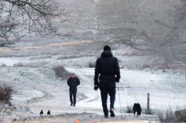
It may nearly be Spring - but Britain is facing snow showers and plunging temperatures(Image: Getty Images)
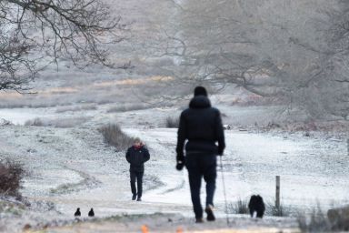
Britain is facing snow showers this week as a brief cold snap is expected to bring plunging temperatures.
The mercury across the country is set to fall from Thursday and may struggle to get into double digits amid a fairly unsettled week of weather, a spokesperson for the Met Office said on Tuesday.
The colder conditions are expected to bring wintry hazards towards the end of the week, including wind, rain and some snow showers, which could fall across parts of Scotland, northern England and Wales.
Weve got areas of showers and rain moving in from the West today, and with that, some quite strong winds into the north west of Scotland moving in today and through the overnight period, said Oli Claydon at the Met Office.
A yellow alert for wind has also been issued for today (Wednesday), with the Met Office warning of severe gales overnight across the Outer and Inner Hebrides, before moving north east across other parts of north-west mainland Scotland.
It may nearly be Spring - but Britain is facing snow showers and plunging temperatures(Image: Getty Images)
Some areas could see gusts of 65mph to 70mph, with a small chance of 75mph to 80mph, according to the Met Office.
Rain and showers should move through fairly readily, leaving drier conditions, Mr Claydon said.
We do see some snow showers over the tops of the Scottish mountains through tomorrow, but thats the very tops of the mountains - nothing really unusual for March, he said.
With that said, the major change is some colder spell that comes through on Thursday.
A weather front moving south-eastwards is set to introduce colder air tomorrow (THURS) and gradually move across the whole of the UK, bringing temperatures down, and bringing with it also the risk of some snow, Mr Claydon added.
The highest chance of snow will be in the north of the UK - particularly in Scotland - into Friday.
There might be some lighter snow showers in other areas such as the Scottish Southern Uplands, and possibly into the North Pennines in northern England.
Weather experts have warned Brits not to pack away the big coats just yet(Image: Getty Images)
Elsewhere, we might see some falling snow further south, in some parts of Wales and higher ground of northern England, but its unlikely to settle around those northern areas, Mr Claydon said.
They are snow showers - its not a widespread front of snow, so not everywhere will see the same level of accumulations, he added.
Wintry showers are set to dissipate throughout Friday, with clearer skies and calmer winds to be expected on Saturday, though temperatures are set to remain chilly.
As we go through Sunday, theres potential for some more unsettled weather, probably introducing temperatures closer to average for that time of year as we sort of move towards the end of the weekend and into next week, Mr Claydon said.
Choose Daily Star as a 'Preferred Source' on Google News for quick access to the news you value.
 [Google Preferred Source Badge]
At Reach and across our entities we and our partners use information collected through cookies and other identifiers from your device to improve experience on our site, analyse how it is used and to show personalised advertising. You can opt out of the sale or sharing of your data, at any time clicking the "Do Not Sell or Share my Data" button at the bottom of the webpage. Please note that your preferences are browser specific. Use of our website and any of our services represents your acceptance of the use of cookies and consent to the practices described in our Privacy Notice and Terms and Conditions.
Accept| Web Proxy Viewer | New URL | Original Page |




![[Daily Star]](https://www.dailystar.co.uk/nav-web-static/main-1203a175ed6ce47e924c82721a3f0ba020eab5f8/public/assets/dailystar/logos/masthead-dailystar-default.svg)
![[Dailystar Icon]](https://www.dailystar.co.uk/assets/icons/daily-star.svg)
![[It may nearly be Spring - but Britain is facing snow showers and plunging temperatures]](https://i2-prod.dailystar.co.uk/article36844936.ece/ALTERNATES/s1200f/0_Local-Weather-UK-2026.jpg)
![[It may nearly be Spring - but Britain is facing snow showers and plunging temperatures]](https://i2-prod.dailystar.co.uk/article36844936.ece/ALTERNATES/s1200e/0_Local-Weather-UK-2026.jpg)
![[Weather experts have warned Brits not to pack away the big coats just yet]](https://i2-prod.dailystar.co.uk/article36844973.ece/ALTERNATES/s1200e/0_Close-up-of-a-woman-hands-in-a-pink-jumper-keeping-warm-by-a-heating-radiator.jpg)
![[Google Preferred Source Badge]](https://www.dailystar.co.uk/_next/image?url=%2Fgoogle-preferred-source-badge-dark.png&w=640&q=75)
![[Ipso logo]](https://www.dailystar.co.uk/footer/ipso.svg)
![[trust project logo]](https://www.dailystar.co.uk/footer/trust-project.svg)
![[reach logo]](https://www.dailystar.co.uk/_next/image?url=%2Fnav-web-static%2Fmain-1203a175ed6ce47e924c82721a3f0ba020eab5f8%2F_next%2Fstatic%2Fmedia%2Flogo-reach.18f672b1.png&w=384&q=75)